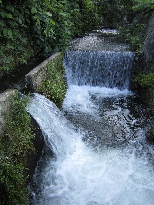
Ogikubo is located in a small valley formed at the foot of the Hakone outer rim ridge, located between the Hayakawa River to the south and the Sanno River to the north. The surrounding area is made up of pyroclastic flow deposits from the Hakone Volcano, and although the topography is gentle, because of advanced erosion, some areas have also become thin and ridge-like. To develop rice fields of Ogikubo located in a small valley with little water, Ogikubo Irrigation Water was drawn from the Hayakawa River through a tunnel in a narrow ridge of the outer rim made up of pyroclastic flow deposits. However, since the outer rim was greatly eroded and the terrain complicated, it was a major construction project with the construction period taking approximately 20 years using culverts and open culverts to penetrate and involved digging more than 40 tunnels including short ones. It is said that the idea and design for the irrigation work were conceived by Hirozo Kawaguchi, a farmer from Kawamuragishi, Ashigarakami District (present-day Yamakita-machi) but it was a public project by the Odawara Clan. The entire length is 10.3km from the water intake in Hakone Town Yumoto to Odawara City, Ogikubo. There is a monument in the Ogikubo area, that says, “Medaka no Gakkou no Furusato (Hometown of Medaka (rice fish) School)”, next to the irrigation water. Additionally, in Kazamatsuri there is the Yamagata Water Source, where water was diverted from this Ogikubo irrigation water and distributed by siphoning to Aritomo Yamagata’s villa Koukian in the Itabashi area. In 2011, it was selected as a Civil Engineering Heritage Site by the Japan Society of Civil Engineers.
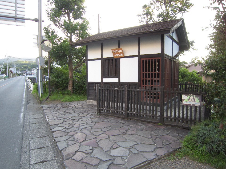
Medaka (rice fish) School