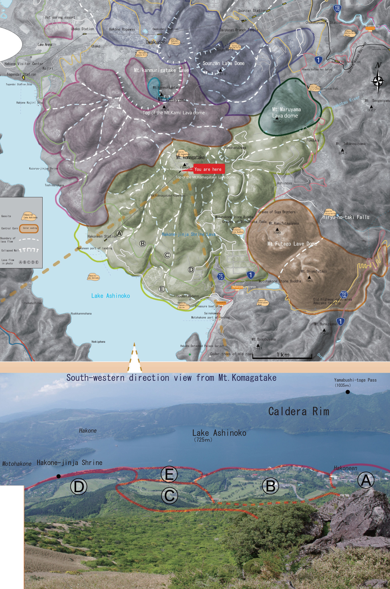
The height of Mt. Komagatake is 1356 meters
It is one of the central cones of the Hakone volcano.
From the summit, you can view Mt. Fuji, Suruga Bay, Sagami Bay, the Shonan coast, the Miura Peninsula and the Boso Peninsula.
If you look at the terrain carefully, you can see multiple sheets of lava flows around the vicinity of the summit.
Mt. Komagatake became active about 27,000 years ago and is a stratovolcano formed by repeated eruptions.
There are large rocks near the summit that are fragments of the lava dome.
These large rocks are ritual ruins that are the basis of advent legends of Kojiki (Record of Ancient Matters) such as “Bakouseki” and “Bajouseki”. Mt. Komagatake.
Mt. Komagatake along with Mt. Kamiyama, the highest peak of the Hakone volcano, has been a sacred place that gathered the faithful from olden times.
During the Nara Period, Hakone-jinja Shrine was opened as the “Satomiya (home shrine)” of Mt. Komagatake by Mangan Shonin (Saint Mangan).
On the summit of Mt. Komagatake, the “Motomiya (original shrine) is enshrined and serves the role as the hall of worship for worshiping Mt. Kamiyama (that is next to Mt. Komagatake).
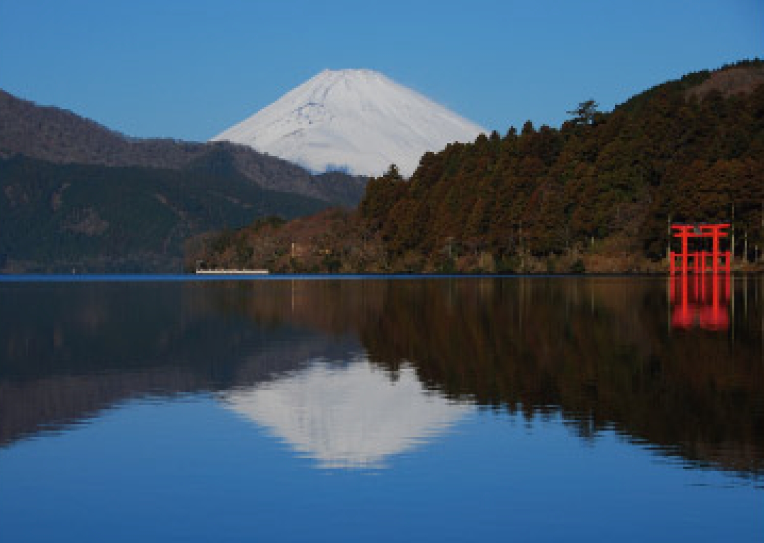
Lake Ashinoko
Approximately 3,000 years ago, the northwestern slope of Mt. Kamiyama collapsed.
The rubble, sand and dirt flowed into the Sengokuhara area and dammed the river forming Lake Ashinoko.
The lake is inhabited by such fish as black bass, rainbow trout, smelt and also a dace with the name hakonensis.
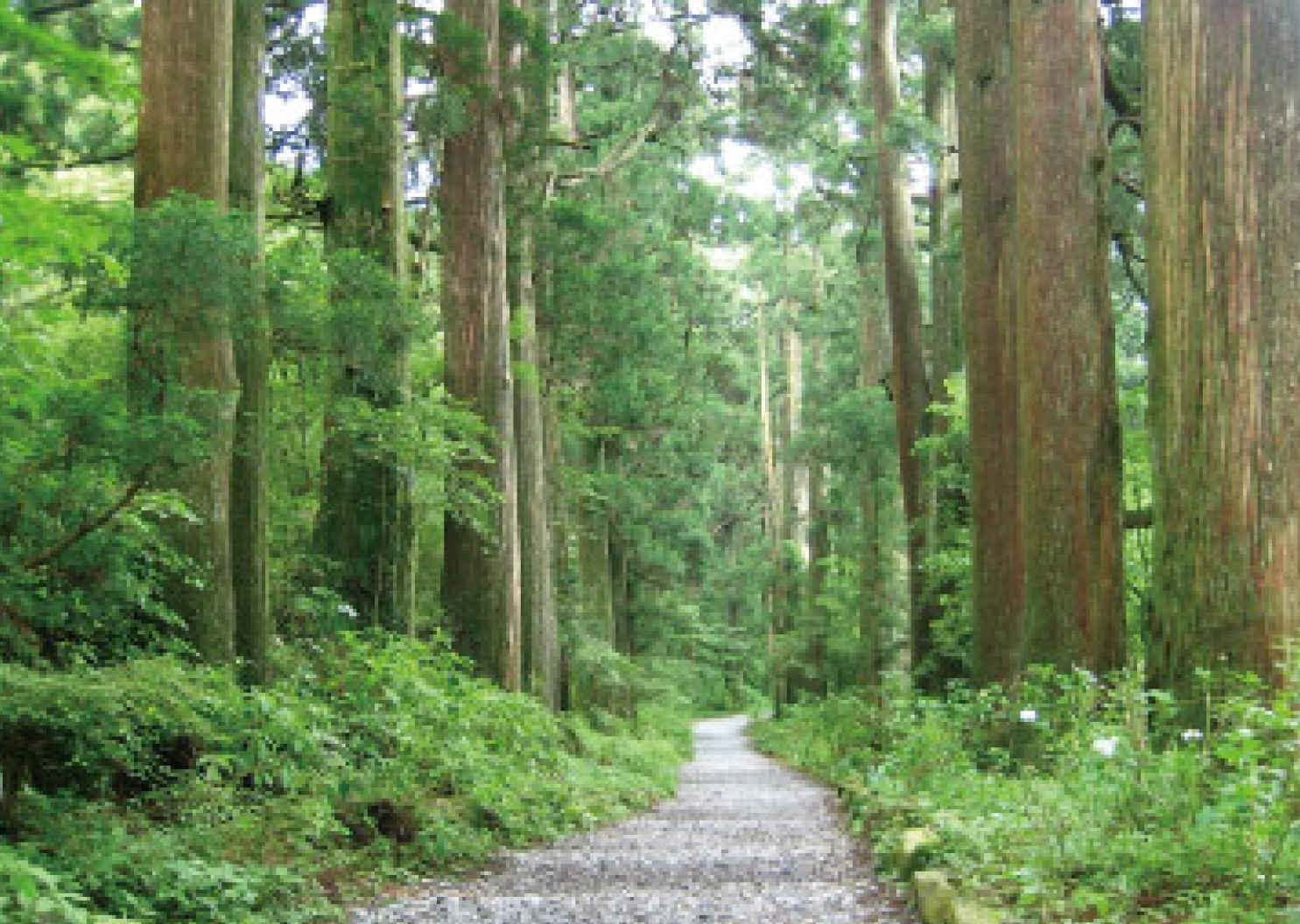
Old Highway and Stone-paved Road
During the Edo Period, milestones were placed and roadside trees were planted along the highway with the maintenance of the Tokaido Highway.
Generally, pine is used as roadside trees however because of conditions relating to the climate around Ashinoko Lake, cedar trees were used.
During the Edo Period, from Odawara Inn to Mishima Inn was called “Hakone Hachiri”. The some of the cobblestones from that time still survive.
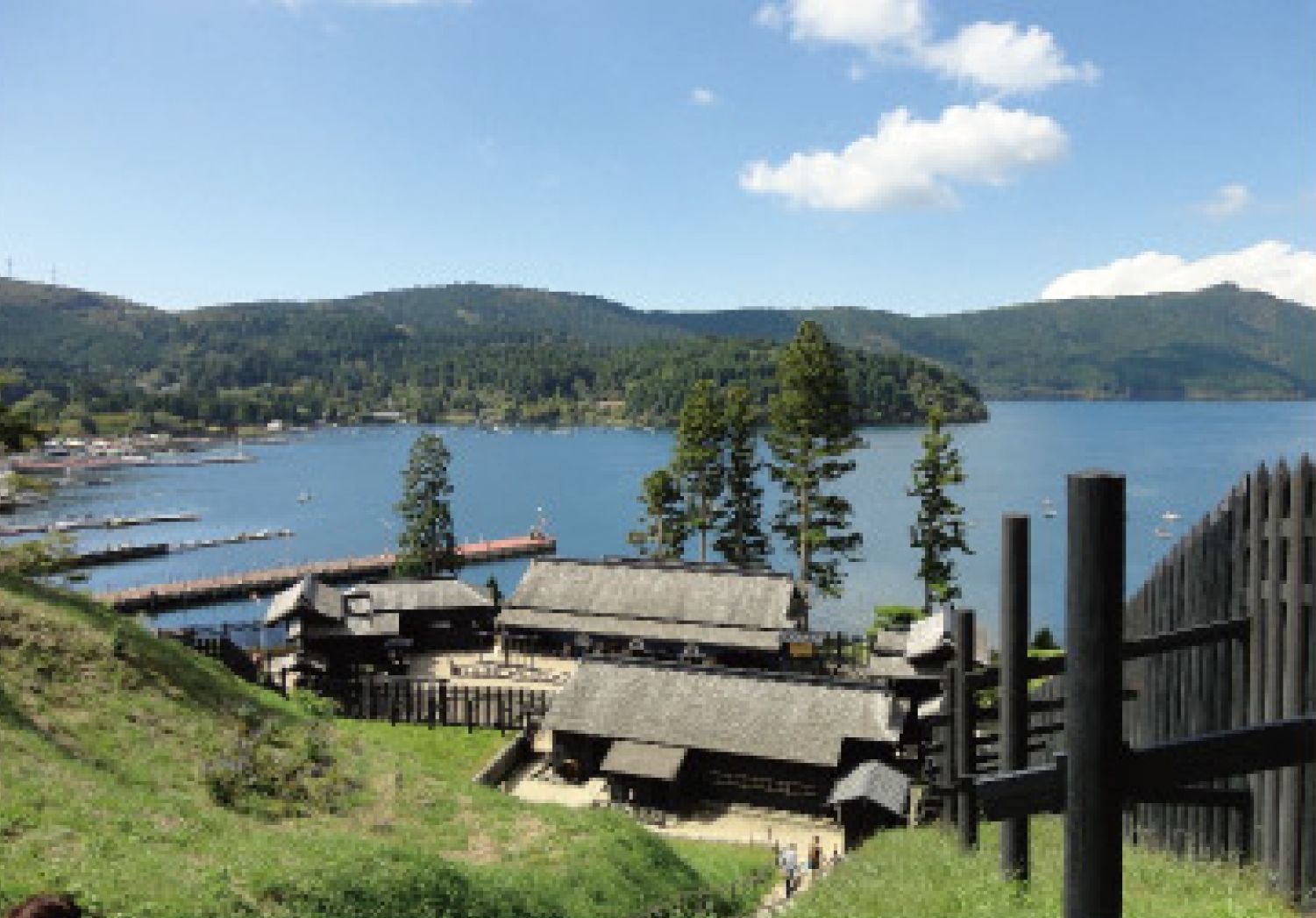
The Hakone Sekisho (Checkpoint)
The Hakone Sekisho (Checkpoint) was created in steep mountains.
The Tokkaido was one of the “Gokaido (Five Routes)” and the Hakone Checkpoint was regarded as important among the checkpoints setup at each location.
The checkpoint was built in the narrow land between Lake Ashinoko and Mt. Byobuyama.
There was a fault related to this terrain.
The terrain was ideal for monitoring the highway.
The checkpoint structure was completely restored in 2007.
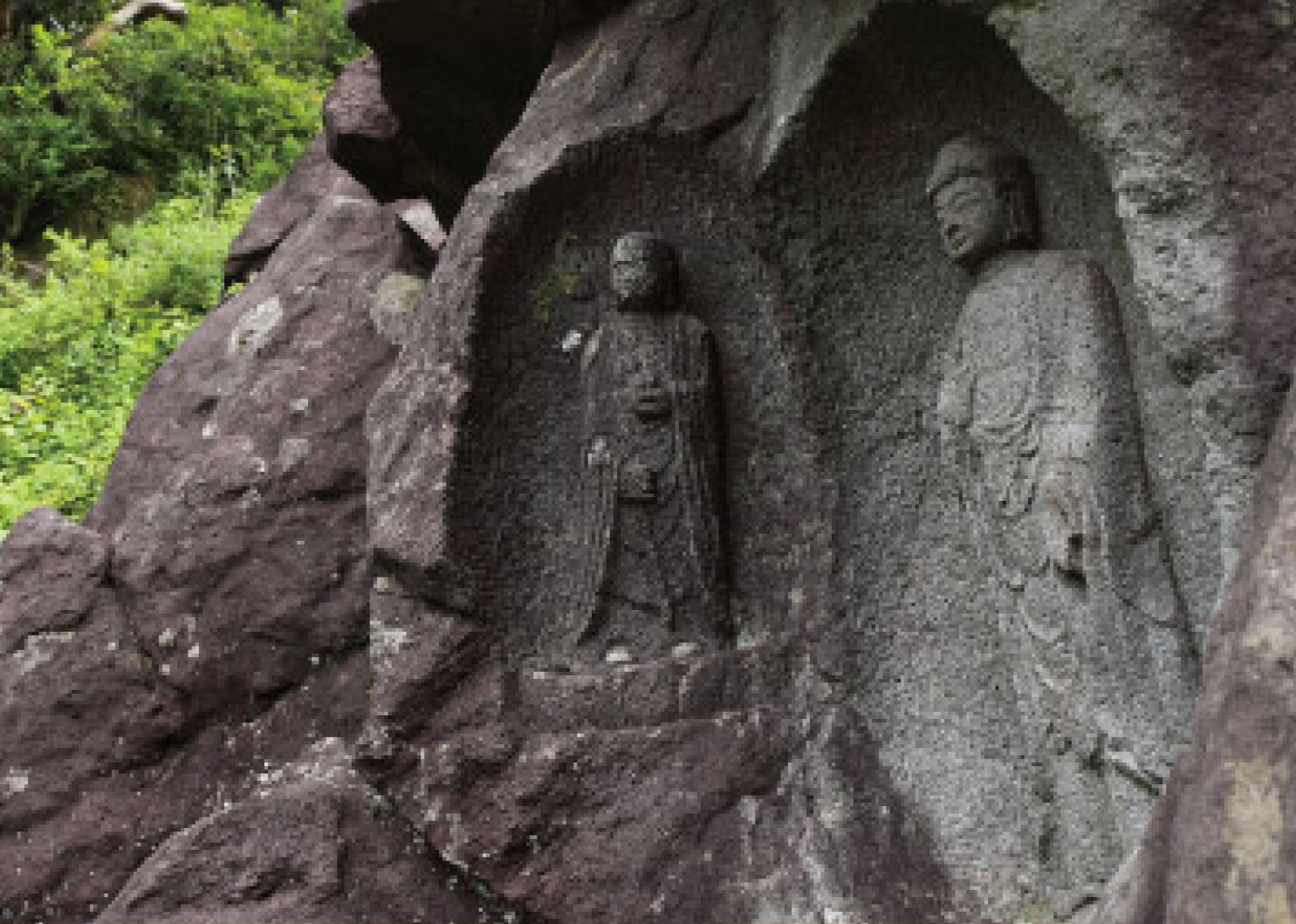
Motohakone Stone Buddhas
During the Kamakura Period, this area was compared to hell.
For this reason, stone Buddhas were created near this area by the Jizo faith.
This area is located at the boundary of Mt. Futagoyama and Mt. Komagatake lava.
These Magaibutsu (relief sculptures) and stone pagodas were carved in the lava of Mt. Futagoyama and Mt. Komagatake.
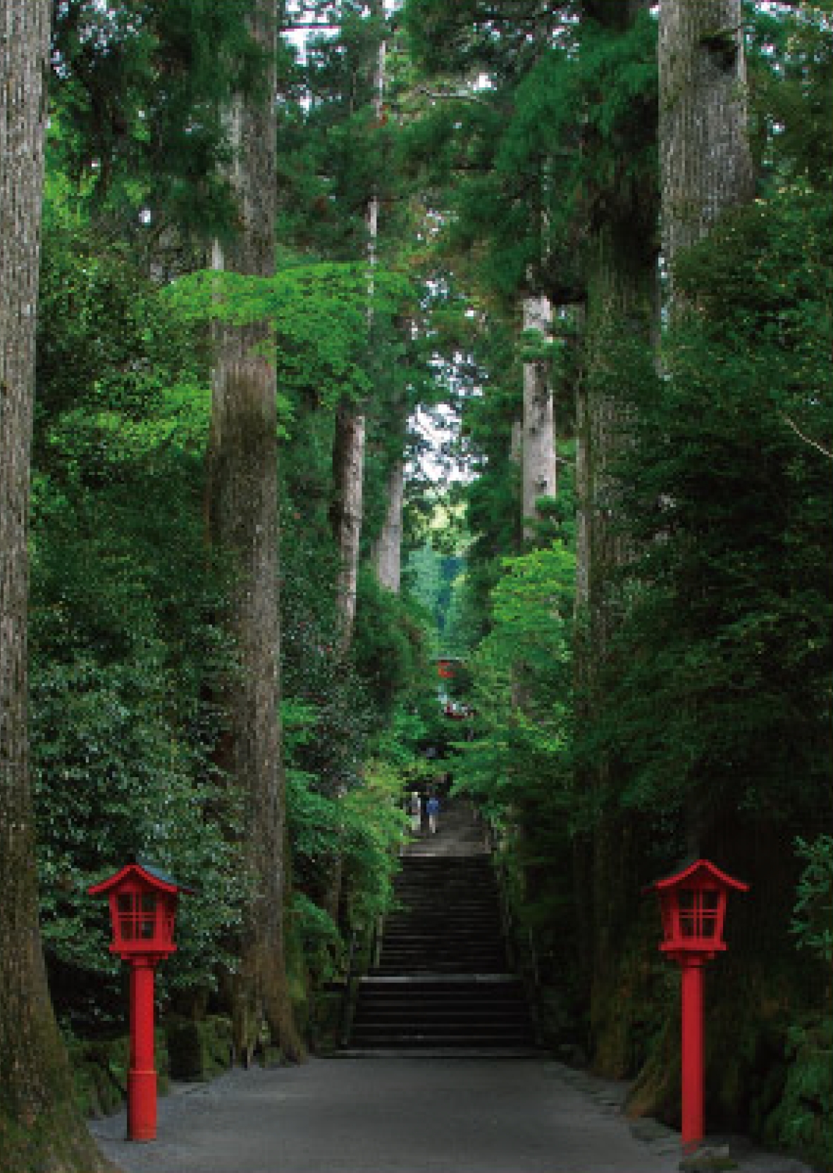
Hakone-jinja Shrine
The shrine was established in year 757 of the Nara Period by Mangan Shonin (Saint Mangan).
The evil dragon that was the lord of the lake was reformed by him. According to legend, the dragon became the guardian deity of the village (Kuzuryumyojin).
A lake festival is held every year on July 31, based on this legend.
The long stairway leading up to the main shrine (photo) is at the cliff at the tip of the Mt. Komagatake lava flow (see map).
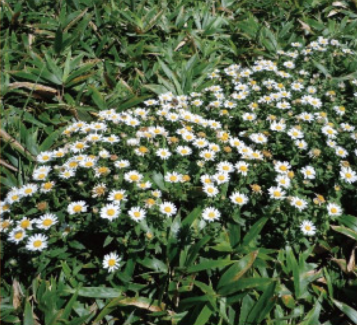
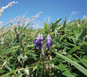
Unusual plants seen at Komagaoka summit
Hakone hrysanthemum
Best viewed between August and September
Hakone monkshood
Best viewed between September and October
*Cannot grow in other areas Please only observe (Do not touch)
(Taking any plants or animals in the National is prohibited)
Central Cone Terrain
The map shows the terrain of the central cone centered on Mt. Komagatake. Mt. Komagatake and Mt. Kamiyama were made through multiple overlapping layers of lava flows and lava domes.