ジオパークって?
「 ジオ(地球)」を体感し、学び、楽しむ自然公園がジオパークです。
箱根ジオパークでは、この地に生息する動植物や私たち人間の歴史・文化と、箱根火山がつくる地形・地質のつながりを見つけることができます。
古くは万葉集に詠われた湯河原温泉は、箱根火山帯の一部である湯河原火山の恵みを受けたもの。湯河原エリア
多くの文豪や芸術家が訪れ、また二・二六事件 の舞台光風荘など、自然の恵みを感じながら歴史文化の情緒を味わうことができるエリアです。
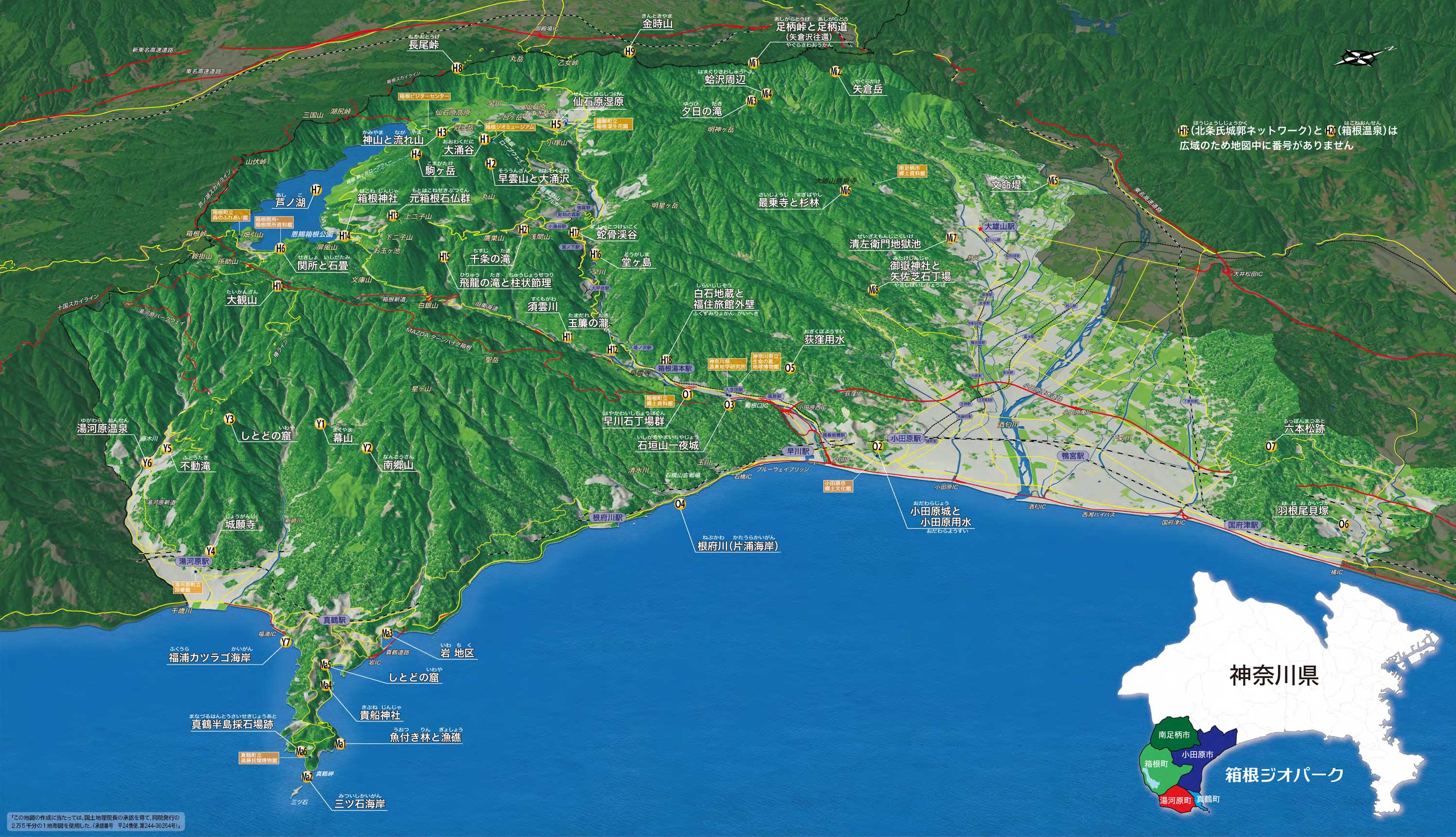
35幕 山
箱根火山の溶岩の壁を背景に約4000本もの梅が咲き乱れる梅林では、毎年「梅の宴」が開催され、また頂上から見渡せる相模灘は絶景です。
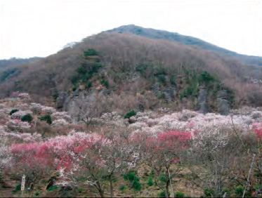
40湯河原温泉
温泉の歴史は古く、その効能は常に高い評価を得ており、江戸時代の温泉番付では東の小結に選ばれるほどでした。
真鶴ではジオの恵みを生かした産業が古くから盛んで、溶岩を活用した石材業、豊富な緑の好影響を受けた漁業が営まれ、ジオと密接に生活を営んできました。真鶴エリア
真鶴の至る所でジオパークを体感することができます。
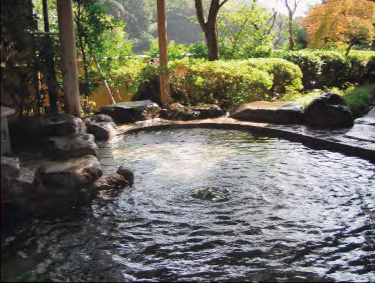
29魚付き林と漁礁
地元の人は真鶴の魚はこの林があるからおいしいと言います。ぜひ、あなたの舌でジオの恵みを味わってみてください。
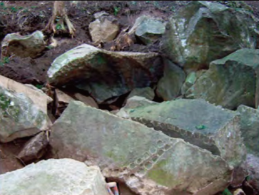
34真鶴半島採石場跡
真鶴の海岸線の多くは海食でできたものではありません。昔は海岸線で採石していたことから、海岸のあちこちに採石した跡(矢穴)を見ることができます。
戦国時代より城下町として栄えてきた箱根ジオパークの玄関口。歴史の舞台となった小田原城や石垣山一夜城には箱根火山の活動による溶岩が石垣として使われ、当時の地質資源の利用や日本の歴史の一端に触れることができるエリアです。小田原エリア
22早川石丁場群
江戸城築城の際、石垣用材が切り出された石丁場の跡です。石材切り出し作業の過程が遺跡として残されており、当時の様子を知ることができます。
23小田原城と小田原用水
上杉謙信や武田信玄も落とせなかった北条氏の城。空堀や土塁などが残され、現在のお堀には、戦国時代から利用されていた小田原用水の水が流れています。
箱根町エリア ジオサイト
40万年前からの火山活動によって形成された箱根火山のカルデラ内に位置し、その地形は複雑をきわめます。湖沼・河川・草原とともに一大自然美を形成し、火山活動による豊富な温泉を有し、大地の活動をダイナミックに感じられるエリアです。
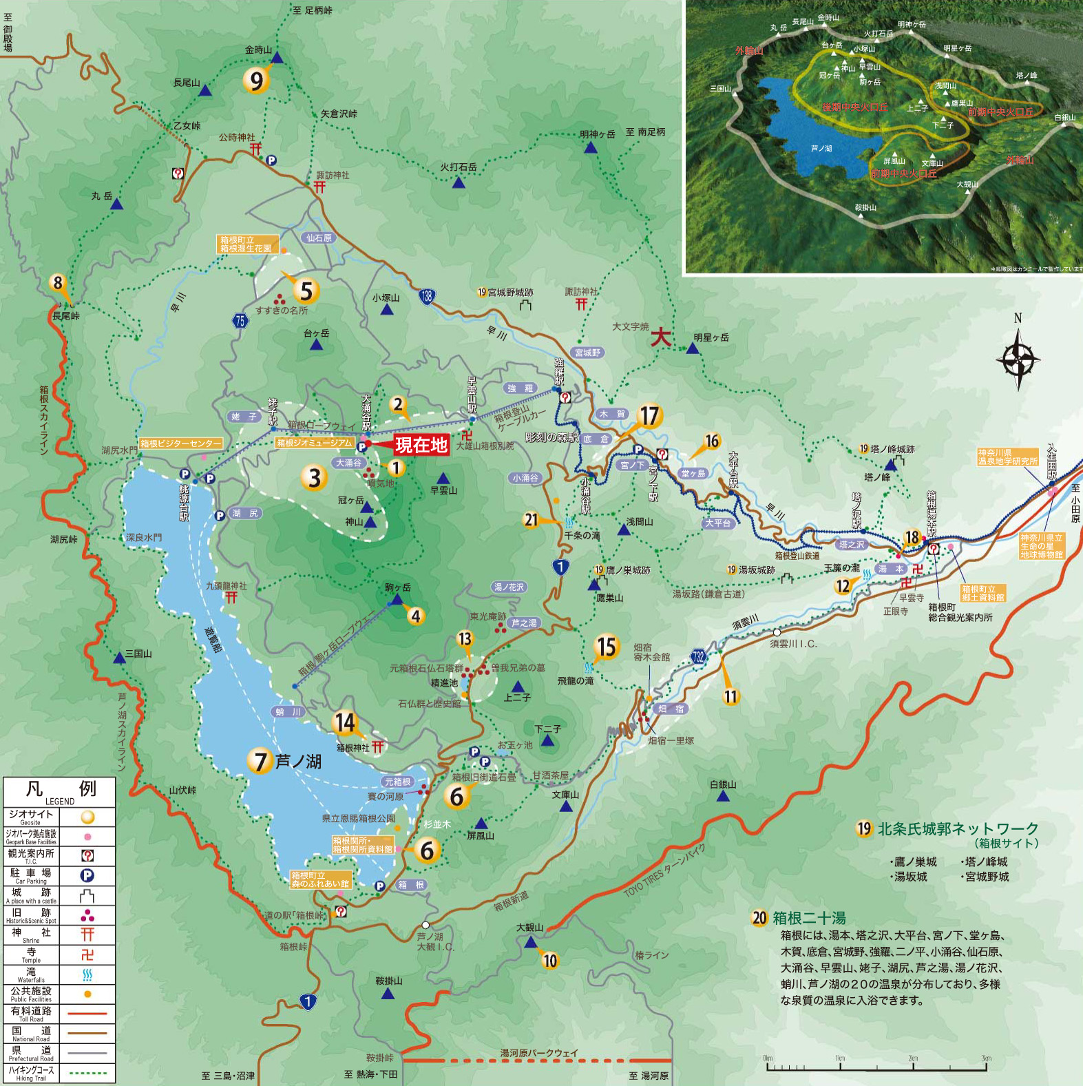
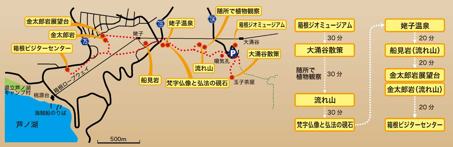
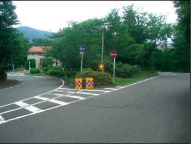
湖尻から大涌谷までの軽登山コース(所要時間2~3時間)
湯本周辺の大地の生い立ちの謎を探りながら、この地の歴史と温泉について知ることができるコースです
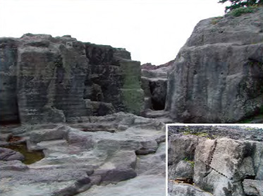
1大涌谷
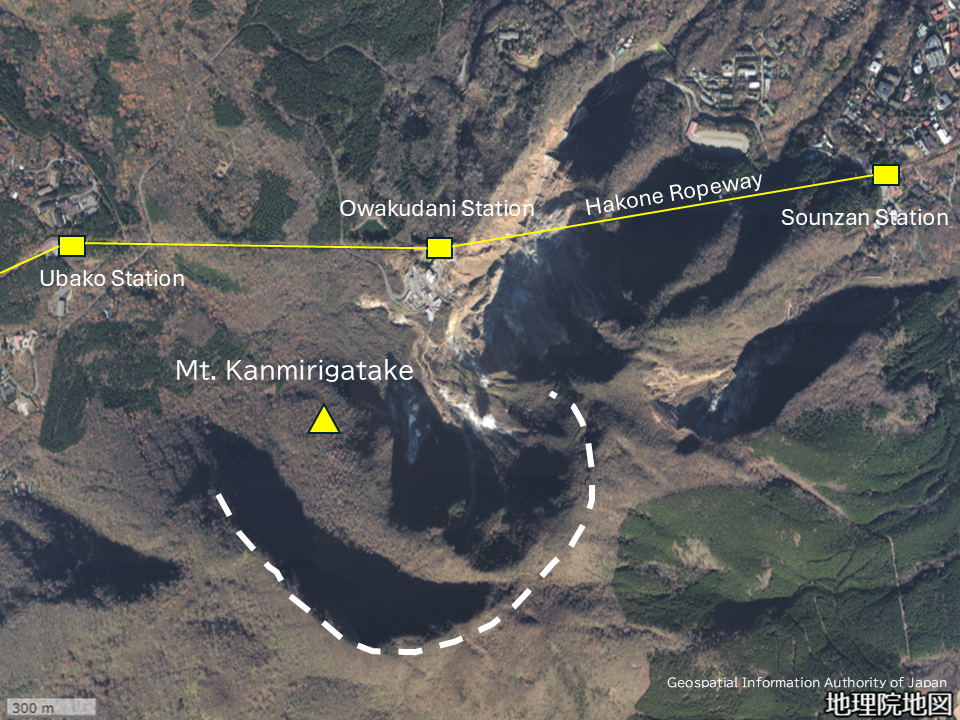
大涌谷は、かつて地獄谷、大地獄と呼ばれた箱根を代表する噴気地帯です。複数の谷地形がみられますが、大涌谷と名付けられた谷はなく、付近一帯を表す地名になっています。
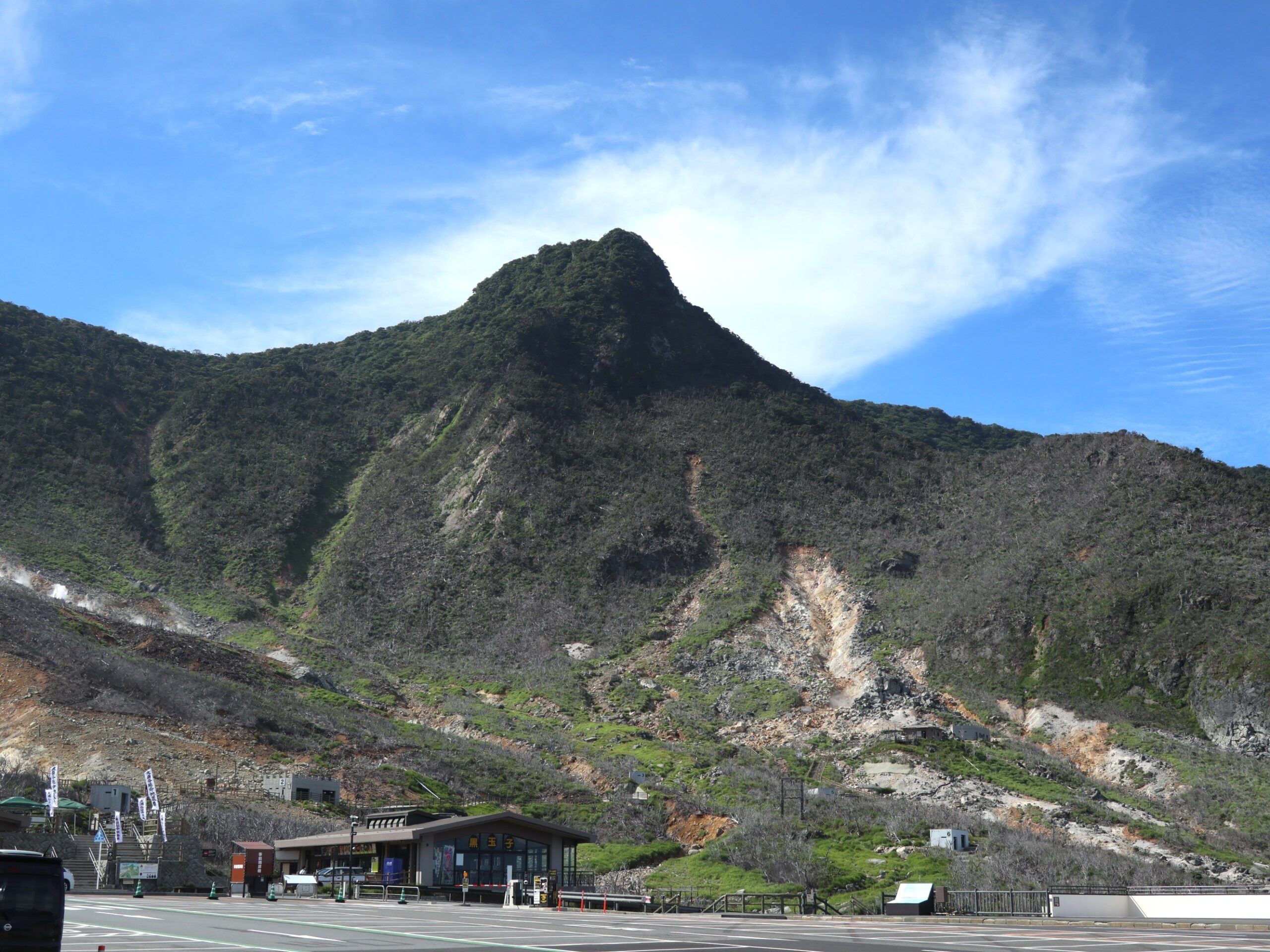
谷の中で最も大きなものは、写真1の白破線で示した馬蹄形の谷です。これは約3000年前に後期中央火口丘の神山の北西側が、山体崩壊を起こして崩れた跡です。冠ヶ岳(写真2)は、その後、崩壊跡に形成された溶岩ドームです。
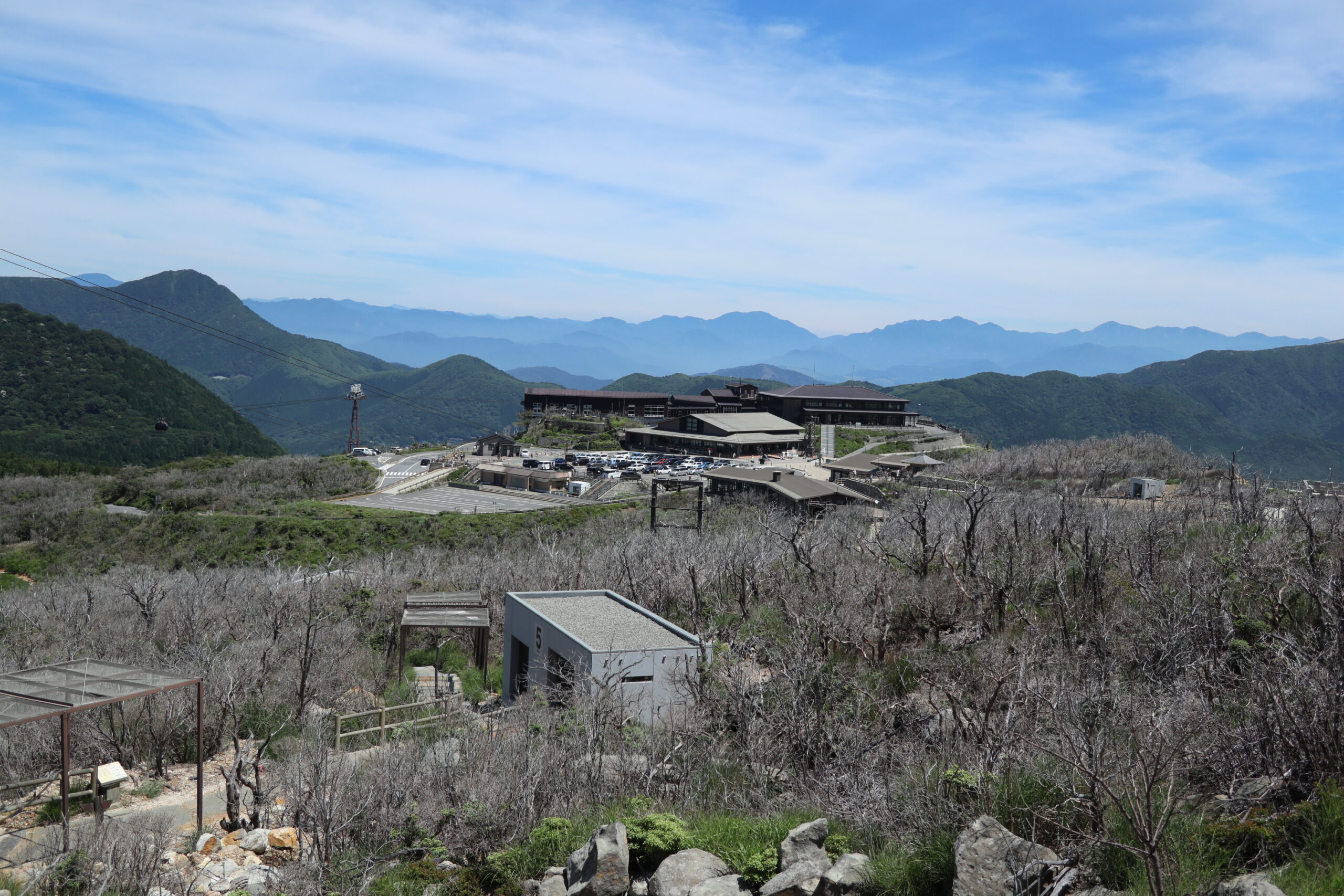
噴気には硫化水素、二酸化硫黄などの有害なガスが含まれ、これらは空気より重いため谷間にたまりやすい性質があります。このため大涌谷として観光開発されているのは、箱根ロープウェイ大涌谷駅から南の冠ヶ岳に延びる尾根状の高台部分(写真3)です。
2015年の噴火以降、7棟の噴石シェルターが整備され、土産物店、駅舎などの周辺の建物も、噴火や有害なガスの濃度が上昇した際の避難所としての機能を持っています。噴気のように目立ちませんが、高温の温泉も複数個所から湧き出ていています。名物として知られる黒たまごは、温泉でゆでた後噴気で蒸した、固ゆでのゆでたまごです。周辺には立ち枯れた木が見られますが、これらは主に2015年の噴火後に上昇した有害な火山ガスで枯死した木々です。
3神山と流れ山
約3000 年前の神山の山体崩壊でできた噴気地帯。周辺では、硫気荒原独特の植物が見られます。
5仙石原湿原

仙石原湖とよばれる湖があった場所。箱根湿生花園では、ノハナショウブなど湿原の植物の観察におすすめです。
6関所と石畳
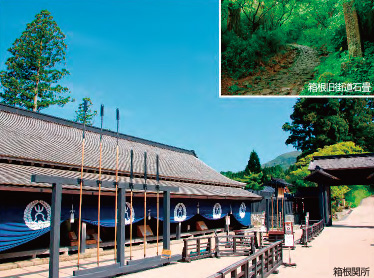
東海道沿いに設置された箱根関所と、箱根に産する石を使った石畳は、江戸時代の様子を伝えています。
7芦ノ湖
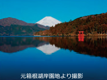
約3000 年前の神山の山体崩壊により現在の姿となった芦ノ湖には、九頭龍の伝説が伝わります。
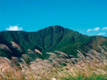
9金時山
約35 ~ 27 万年前に活動した成層火山で、「宿り石」や「手毬石」など金太郎にゆかりの見どころもあります。
14箱根神社
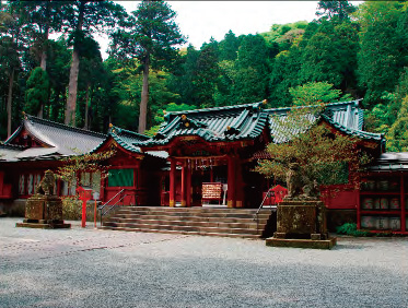
箱根山が山岳修行の場であった奈良時代に万巻上人が創建し、源頼朝など武家の信仰も集めた神社です。
15飛龍の滝
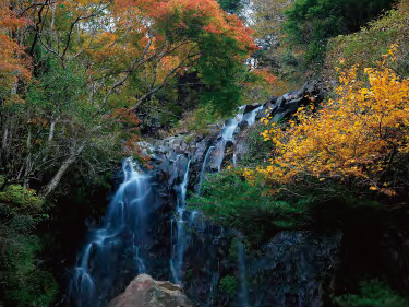
約12 万年前に噴火した溶岩からできた滝で、鎌倉時代には、箱根権現信仰の行者が身を清めていました。
17蛇骨渓谷
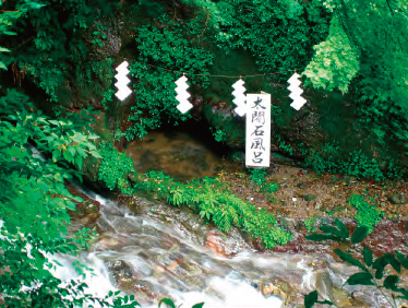
1590 年に豊臣秀吉が小田原北条氏を攻める際に、家臣を癒したとされる「太閤の石風呂」があります。