What is a Geopark?
Hakone Geopark is a natural park that offers opportunities to experience, learn, and enjoy geological activities.
Visitors can discover the link that connects the local plants and animals as well as our own history and culture with the geographical characteristics created by Hakone Volcano.
Yugawara Area
Yugawara onsen (Yugawara hot springs) was sung from long ago in Manyoshu (the oldest Japanese anthology) and benefited from the Yugawara volcano which was part of the Hakone volcanic zone. Many distinguished writers and artists have visited here and was the stage of the February 26 incident at Kofuso. In this area you can feel the blessing of nature while experiencing it historic culture.
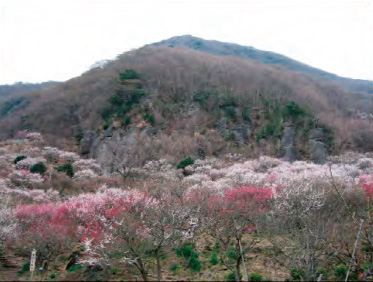
35Mt. Makuyama
At the ume plum grove where 4,000 plum trees blossom against the backdrop of the lava wall of the Hakone volcano, a “Ume-no-utage (Plum Feast)” is held every year and the view of Sagaminada from the summit is breathtaking.
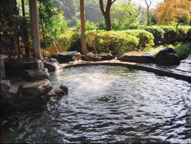
40Yugawara Onsen (Yugawara Hot Springs)
The hot springs has a long history and its efficacy has been highly regarded. In the Edo period, it was even ranked as Komusubi (4th highest) of the East in hot springs rankings.
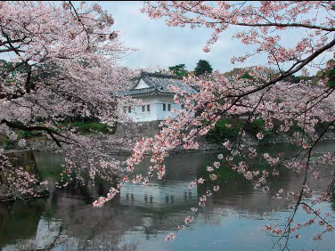
Hakone Area
The Hakone Area is located in the caldera rim of the Hakone Volcano that was formed by volcanic activities about 400 thousand years ago. Because of this, the landscape is complex. This area is comprised of lakes, rivers, grasslands and has a wealth of hot springs formed by volcanic activities and the dynamic activities of the earth can be felt in this area.
1Owakudani(Fumarole Field)
Owakudani is an area with constantly rising gases and the smell of hydrogen sulfide lets you closely feel the breath of the volcano.
Owakudani is a Geosite that represents Hakone Geopark.
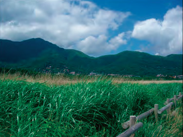
5Sengokuhara Marsh
Sengokuhara Marsh is where there was a lake that once was spread out around the Sengokuhara area and later turned into wetlands.
At the Hakone Botanical Garden of Wetlands adjacent to Sengokuhara Marsh, many varieties of plants that live in the wetlands can be observed.

Odawara Area
The entrance to Hakone Geopark flourished as a castle town from the Sengoku (warring states) era. Odawara-jo Castle and Ishigakiyama ichiya-jo Castle that became the stage of history, used the lava from the activity of the Hakone volcano to make a stone wall and is an area where you can see usage of the geological resources and touch a part of Japan’s history of that era.
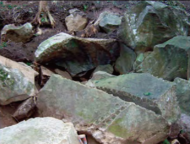
22Hayakawa-ishichouba-gun (Stone Quarry Sites)
During the fortification of Edo-jo Castle, this is the remains of where materials for stone walls where cut out from the stone quarry. The ruins of where the rock cutting work took place remain and can tell you what it was like at that time.
23Odawara-jo Castle and Odawara Irrigation Channels
The castle of Hojo that even Uesugi Kenshin and Takeda Shingen could not defeat.
An empty moat and earth walls remain and currently water from the Odawara Irrigation channels from the Sengoku era flows in the moat.
Manazuru area Geo map
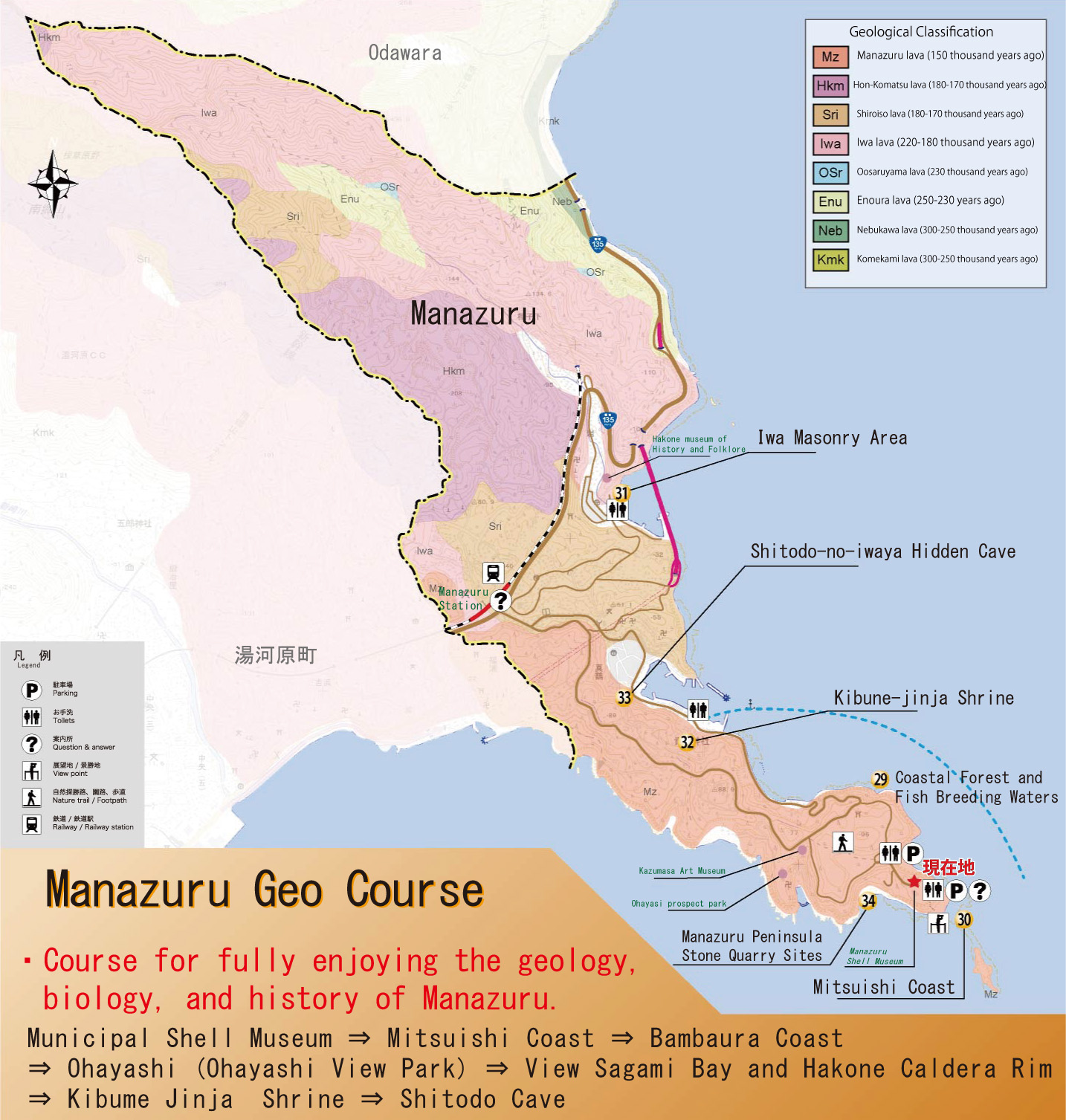
Manazuru had thriving industries that took advantage of the blessings of “Geo (earth)” from ancient times, stone industry that utilized the lava, fishing industry that received the favorable effects of the abundant greenery, and lived closely with “Geo”.
You can experience Geopark throughout Manazuru
29Coastal Forest and Fish Breeding Waters
The local people say that the fish of Manzuru tastes delicious because this forest.
By all means, please taste the blessings of Geo for yourself.
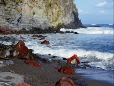
31Iwa Masonary Area
This location is where Yoritomo set sail to Awa at that time (Chiba) in order to stage a comeback.
You can see red colored volcanic rocks here.
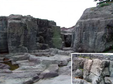
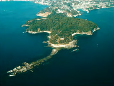
34Manazuru Peninsula Stone Quarry Sites
The majority of the shoreline of Manazuru was not created by sea erosion. In the past, stone was quarried from the Manazuru shoreline and you can see traces of the quarries in various areas of the shoreline (arrow holes).